Today we are off up to The Iveragh Peninsula in Kerry. It's drizzling as we leave, but has brightened up some by the time we go through Kenmare - then anti clockwise round the Ring of Kerry.
The main purpose for today's trip, is to find a couple of wedge tombs in the townland of Coomatloukane/Com An tSleabhcáin, which is near Derrynane.
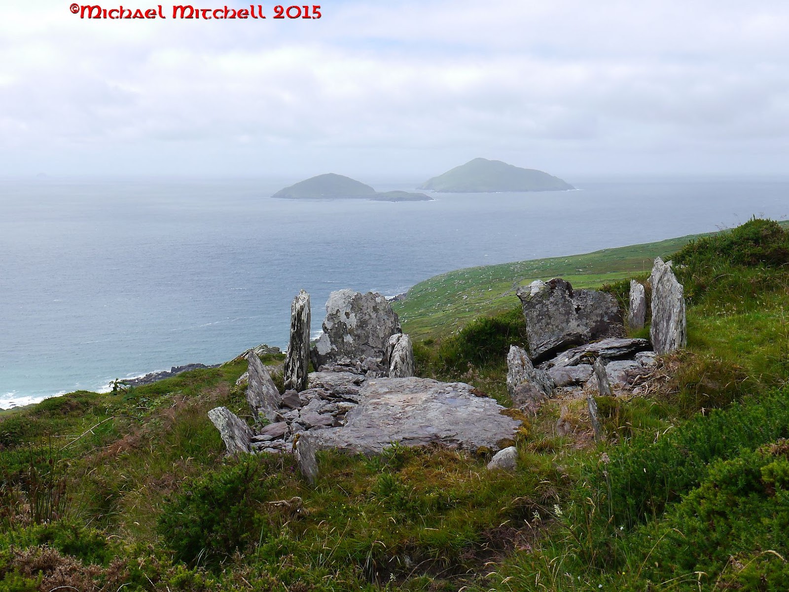
There are some layby's for parking on the N70, just past where the Kerry Way goes off up the hill to the right.In fact, the first of today's wedge tombs is about 100m up that very path. Cross the stile and follow the track up and you will see it on your right (complete with sign board). A neat little wedge tomb, perched on the hillside.


This one is a lot bigger and and in a fantastic position, facing out towards Deenish and Scariff Islands and the Atlantic Ocean. A family of Choughs call from a little way off and a pair of Stonechats keep a close eye on what we are up to. This is a wonderful place it is easy to forget that there is a busy tourist road just 100m above, as we sit in our solitude and soak it all in.

Eventually, we head back for the car and carry on our journey, stopping briefly on the corner at the big Mary statue. You can look right down to Waterville and about half way sits the magnificent Loher (An Lothar) stone fort.

There is a lane leading up to a few houses. On the left is a drive to a small house. We have knocked here before for access, but today, as then, there is no answer. The place looks like a holiday home and there is a gap in the hedge which leads into the field. So, that's where I go. Wandering over, I am suprised to find a land rover parked by the stones, with two archaeologists (who are doing some survey work),having their lunch break. I take some photographs before they get back to work.


Next, we head into Waterville, taking the first right and heading towards the GAA ground. In the boggy field to the right stands another standing stone. This one stands at 1.75m x 0.4 x 0.13 and is aligned E-W.


No comments:
Post a Comment